 |
 |
 |
 |
 |
 |
 |
 |
 |
 |
 |
| All rights reserved. |

CANEEL HILL SPUR TRAIL
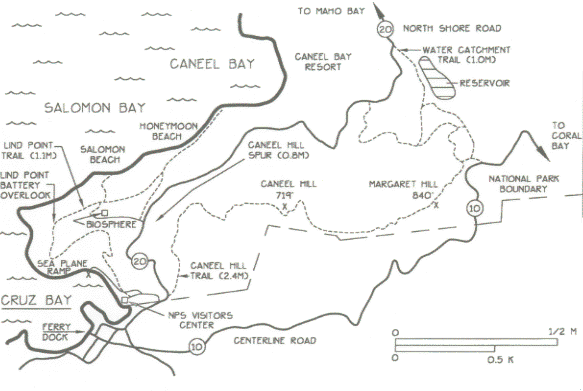
Map by Neal Sullivan
This trail connects the LIND POINT TRAIL near Honeymoon Beach with the CANEEL HILL
TRAIL. The trail is 0.8 miles in length and gains about 300 feet of altitude. It crosses route 20 near
the entrance to the National Park Housing at Lind Point where there is parking for about four
vehicles near the trail at the beginning of the road.
This trail is used primarily by hikers on their way to HONEYMOON BAY or as a means to get to
the Caneel Hill Trail from the hotel at Caneel Bay.
© 1996 by Gerald Singer
St. John, US Virgin Islands

A Great Place to Visit.....again & again
[email protected]